

Click image for source information.

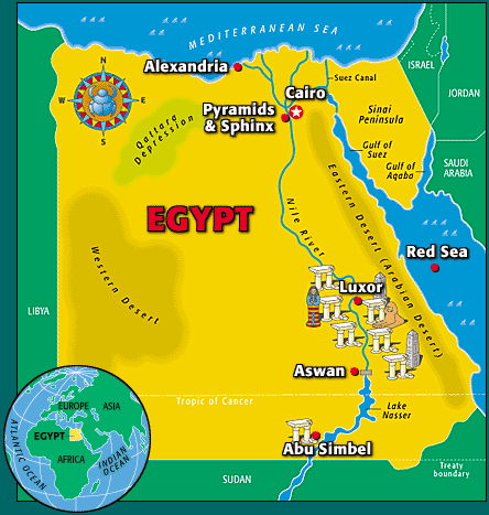
Location:Northern Africa. Egypt borders the Mediterranean Sea in the north, Israel in the east, Sudan in the south and Libya in the west.
Area:Total: 1,001,450 sq km
Land: 995,450 sq km
Water: 6,000 sq km
Climate:Desert: hot, dry summers with moderate winters
Elevation:Lowest point: Qattara Depression -133 m
Highest point: Mount Catherine 2,629 m
Click image for source information.
Before civilization, early humans came to the Nile River to hunt, fish, and gather food. This eventually led to permanent settlements. Several towns grew and eventually kingdoms developed. The change from nomadic hunter-gatherers to civilized living followed the same pattern as other places around the world: farming provided extra food, which allowed the division of labour, which allows the development of government and religion and creates social classes.
Starting around 5500 BCE two major kingdoms developed along the Nile. Historians call them Upper Egypt and Lower Egypt. Around 3200 BCE, Egypt was brought together under one ruler—King Narmer (sometimes called Menes). This is recognized as the beginning of the Egyptian civilization.
For a virtual tour of Ancient Egypt click here.